Showing posts with label Canada. Show all posts

Saturday, July 9, 2011

Windy Day in Nuchatlitz

By Nicole

From our anchorage in Port Langford off Nuchatlitz Inlet, we had no real indication that a gale was blowing just over the hill.  Except for the fact that Environment Canada, the agency responsible for the weather reports we get over our VHF radio, was repeatedly warning of gale-force winds in the area (that’s 39-54 mph).  So of course we had to take a little dinghy ride to see all this wind for ourselves.

IMG_1568_thumb3
Off on a dinghy adventure in Port Langford

So what does wind that strong look like?

Exhibit A:IMG_1627_thumb3
Look how long Aaron’s hair is getting!  I didn’t even get it all in the picture.  I’m going to have to start French braiding it to keep it out of his eyes before too long.

Exhibit B:DSC_0452_thumb2
The wind was roaring out of the northwest and across the shallow water of the Nuchatlitz area.

Our exploring also took us to a sandy beach (that smelled like sulfur – there are a number of hot springs up here) and to a daisy-covered hill. 

IMG_1630_thumb2
Daisies in full bloom!

Aaron bravely searched for treasure in a sea cave, but all he found were logs and seaweed.

IMG_1615_thumb8
No treasure, no bats and no stalactites

We savored our two nights in Port Langford, thinking that this may be the last time we have an anchorage to ourselves for quite some time.  Well, I guess we weren’t really alone, since we did share the spot with a seal, a sea otter, three deer and two black bears.  And loads of bald eagles.  And thousands of jellyfish.

IMG_1640

And maybe a sea urchin or two.

Friday, July 8, 2011

S’mores!

By Nicole

I really love s’mores.  And Aaron really loves to build campfires.  We’re a perfect match.

IMG_1583
Aaron’s mighty beach fire (with Bella Star in the background)

IMG_1604
Yep, we’re expert marshmallow toasters.  We even have our own sticks.

IMG_1607 
The first bite’s always the best.

IMG_1610 
But the second bite’s pretty good too!

Beach fires and s’mores… does it get any better?

Dixie Cove’s Sleeping Sea Otter

By Nicole

Sea otters are a common sight up and down the west coast of Vancouver Island.  They’re easy to spot, as they float along on their backs with their heads and feet sticking out of the water.  We never get tired of watching them munch on shellfish snacks, using their tummies as tables.

A certain sea otter in Dixie Cove managed to take the “cutest critter” prize, although Aaron thought maybe it was dead.  As we drifted over to it in the dinghy, we heard the unmistakable sound of snoring.  The otter wasn’t dead, it was sleeping!  And sawing little sea otter logs.  Her paws were tucked up under her chin, her eyes were closed and she was just snoozing away, oblivious to us and our dinghy.  It was quite honestly one of the cutest things I’ve ever seen.  Of course our giggling woke her up, but at least we got a picture first.

IMG_1489Sleeping sea otter

Later that afternoon, s/v Osprey rowed over with some freshly baked blueberry muffins and an invitation to hike to the top of the ridge above the anchorage.  We’re in!

IMG_1494
Hubert rowing us to shore to begin our trek

With Hubert blazing the trail (this wasn’t a hike but a full-on bushwack through the woods and underbrush), we made it to the top.  Phew!  And what a view of the anchorage and mountains below…

IMG_1509
Mighty trailblazers!

IMG_1500

IMG_1518
You can just make out Bella Star through the trees and Osprey off in the distance.

Dixie Cove was a lovely spot, but I still can’t get “Dixie Land” out of my head.  Look away, look away, look away Dixie Land.

You’re welcome.

Socializing in the Bunsbys

By Nicole

Soggy day heading south from the BunsbysNorthwesterners like to joke that summer doesn’t start until after the 4th of July.  I don’t know what it’s doing back in Seattle, but we’re having monsoon season here on Vancouver Island.  Holy crap, has it rained a lot in the last week (and that’s coming from someone who’s lived in Washington for 30 years).

Despite the extra-soggy conditions (or maybe because of it) the Bunsby Islands proved to be a hotspot for socializing. 

Our friends on s/v Estrellita met us there, so of course we spent lots of time with them playing games, hatching plans to get ourselves to Mexico ASAP and drinking killer mulled wine (which fit perfectly with the whole “Christmas in July” weather we were having).

We also shared the anchorage with Rosmond, Slip Stream II and My Wind Song, the three boats we’ve been leap-frogging down the coast with.  They’re a great bunch of people, and Rosmond was even nice enough to invite the whole crowd over for a rainy day happy hour – good times!  (Ladies, as promised, the recipe for the cheese straws is below!)

I’m sure the Bunsbys are lovely in sunny, settled weather, but when we heard the forecast call for a break in the southerly gale-force winds, we waved goodbye to Estrellita and made a run for it.  Of course the forecast was wrong (SW 20+ knots instead of W 10 knots), but we pushed on through the driving, sting-your-eyeballs rain to Kyuquot.  If we’re lucky, the rain will be gone by tomorrow – although as I write this, it’s still a few days until July 4th, so I’m not holding my breath…


Cheese Straws

These cheesy, salty, crunchy snacks are the perfect happy hour nibble – and they satisfy my Cheez-It craving.  (Adapted from Smitten Kitchen)

1 ½ cups finely grated extra-sharp Cheddar cheese (or try a blend of Cheddar and Parmesan)
4 tablespoons butter, cut into small pieces
3/4 cup flour
1/2 teaspoon coarse sea salt or kosher salt
1/2 teaspoon crushed red pepper flakes
1 tablespoon cold water

Preheat oven to 350 degrees. Line a baking sheet with parchment paper.

In a large bowl, add cheese, butter, flour, salt and red pepper flakes. Using a pastry blender (or two forks), combine until the mixture resembles coarse crumbs. Add water and knead 5 or 6 times to bring the mixture together into a ball. The dough can be refrigerated at this point, wrapped in plastic, for a day or so.

On a lightly floured surface, roll the dough into a thin rectangle, about 8” x 10” and no more than 1/4” thick. Using a floured pizza wheel (or a sharp knife), slice the dough into strips (anywhere from 1/4” to 1/2” wide and as long as you like). Transfer to the parchment-lined baking sheet, leaving 1/4” between pieces. If desired, sprinkle lightly with sea salt.

Bake at 350 for 14-16 minutes, or until very pale golden brown. Transfer to a cooling rack. Store for a day or two in an airtight container.

Saturday, July 2, 2011

Quatsino Sound–Beaches & Bears

By Nicole

Why are we doing this?”  Aaron peeked/glared at me from under his dripping rain hood as we motored along in the dinghy, dodging patches of kelp in the pouring rain.

Practically in answer to his question, a furry sea otter poked up out of the water to check us out.  We exchanged curious glances with the little guy, as he floated along on his back through the kelp.  He followed us around for a bit, popping up here and there and generally being adorable.  Due to the downpour, I kept the camera in my pocket, so no otter pictures, though.

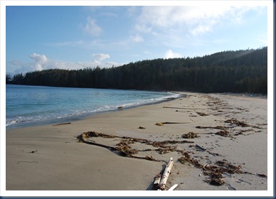
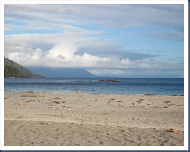
The rain stopped soon after, and we landed the dinghy on a beach to walk on real sand.  Sand!  After all the rocks and boulders and glacial till of the Inside Passage, we’d been craving sandy beaches.IMG_1188
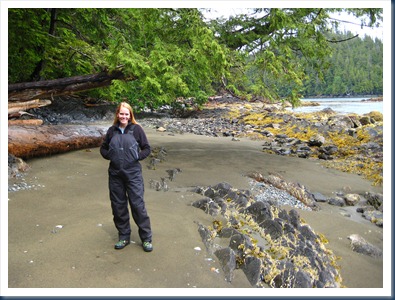
Foulie pants and real sand

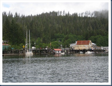
The next day, a 30-minute dinghy ride led us from our anchorage in Browning Inlet to the village of Winter Harbour.  It’s more of a fishing outpost than a village, but we managed to get a few groceries (marshmallows for s’mores was top of the list).

We bumped into three of the boats we’d rounded Cape Scott with and had a nice time chatting while waiting for the store to open (Hours: 3pm-7pm – gee, how handy).  As it turns out, Allison from s/v Rosmond follows our blog (hi, Allison!).  What a small world…  We hope to run into them again soon.
IMG_1216
The rustic village of Winter Harbour.

IMG_1217
Winter Harbour’s post office, complete with a sweet old guard dog (Aaron gave him plenty of attention).

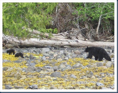
Remember when we were lamenting the fact that we hadn’t seen a bear yet?  Well, we saw eight black bears in one day here, including a momma and her two cubs.  I even managed to get  a decent picture this time.
IMG_1214 
Cute black bear cubs and their mother

Thus, I broke out my trusty bear bell again for our hike through the woods in search of a beach our friends Lance and Carol on s/v Syrah claimed was straight out of Mexico.  How could we pass up a chance to see Mexico in Canada?

The trailhead shown in the guidebook was guarded by a bear when we arrived (swell), but as it turns out, the book was wrong about the location anyway.  Farther down the inlet we saw the conspicuous Vancouver Island trail marker – brightly colored fishing floats and other flotsam tied to a tree.  Fantastic – but how did we get the dinghy through the muddy marsh when the water was only a few inches deep?  Good question.  Here’s your answer:

IMG_1224
Mush, Aaron, mush!  Yep, I’m riding.

Fearing for our lives (who wants to be eaten by a bear?), we tried to be as loud as possible while hiking the trail.  It was so overgrown with salal, salmonberry bushes and assorted other forest shrubbery that some resourceful individual who tromped through before us (probably last year by the looks of things) tied pink surveyor’s tape to branches along the way.  In many places we couldn’t see the trail at all, so we picked our way from one piece of pink tape to the next.  It was getting late, and at one point we considered turning back.  But we kept hearing Lance & Carol’s voices in our heads.  So we pushed on. 

And this was our reward at the end of the trail:

DSC_0377

DSC_0370

DSC_0374

IMG_1239

DSC_0372

IMG_1241

IMG_1238
Did not get eaten by bears hiking to Grant Bay

This West Coast of Vancouver Island stuff is pretty effing awesome.

Great Scott!

By Nicole

As we rounded Cape Scott at Vancouver Island’s northwestern tip, blue sky began to peek out from the breaking clouds.  With the mainsail hoisted and the jib unfurled, we were sailing in a fresh breeze, riding up and down in the 6-foot seas watching whales surface nearby.  While it certainly wasn’t like rounding the Cape of Good Hope or Cape Horn, it was still an exhilarating moment for us.

We’d been eagerly planning for this leg of our journey, which would take us from the relative shelter of the Inside Passage, nestled between Vancouver Island and the mainland of B.C., to the wild and rugged Pacific Ocean.  At Cape Scott, strong winds meet forcefully (and often violently) with ocean swell and currents.  Rocks lurk well offshore, and if not timed and navigated prudently, the rounding can be dangerous.

IMG_1168
To port, Cape Scott…

IMG_1164
… and to starboard, Japan across the vast Pacific Ocean

Four other sailboats rounded the Cape with us, and three of them (great folks we met later in Quatsino Sound),  chose to stop at Sea Otter Cove.  But we were making good time, so we decided instead to keep going to Quatsino Sound, another ~5 hours south. 

IMG_1171
On our way to Quatsino Sound on Vancouver Island’s stunning Pacific Coast

IMG_1165 
We made it around Cape Scott!  Yay!

It was a long, tiring 10-hour run from Bull Harbour to Quatsino Sound, but to finally be on the ocean made it so worth it.  From what we’ve seen so far, the coastline here is spectacular, and we can’t wait to spend the next 6 weeks enjoying it.

Saturday, June 18, 2011

Seven Days in Blunden Harbour

By Nicole

One of our guidebooks erroneously refers to Blunden Harbour as “Blunder” Harbour.  Sure it’s an obvious typo, but for us, our week here was anything but a mistake.

Lagoon

Blunden Harbour is a maze of twisting passages where around every corner waits another small island.  We found ourselves getting turned around as we wound through the labyrinth in our dinghy.

IMG_0995

Our destination was a saltwater lagoon that’s only accessible for a short window of time at high-water slack (the moment when the tide is at its highest point and it pauses ever so briefly to reverse directions).  At any other time, it’s a turbulent tidal rapids with whirlpools and strong currents.

We made it into the lagoon just fine, riding the last of the flood current, but getting out was another story. Apparently high-water slack here occurs two hours after high tide in the main harbor.  Which meant we had a fun ride into the lagoon… and had to wait more than an hour until we could get back out.  With our piddley  2-hp outboard, we can travel about 4 mph, but the current was far stronger than that.  Even at max throttle, we were getting pushed backwards by the force of the current. 

IMG_0968
Whirlpools and strong current piping into the lagoon proved too much for our outboard

So we pulled up to some large rocks along the shore and waited an hour or so until the current subsided (until it really was high-water slack).  We watched leather stars go about their starfish business and hermit crabs fight each other for rights to an underwater domain.

IMG_0972
 

Shell Midden

IMG_1102The shell midden beach on the north side of the anchorage marks the site of a former Kwakiutl village.  Many native villages in British Columbia were settled near rich shellfish beds, especially clam beds. Villagers harvested and ate the clams, then dumped the shells in refuse piles called middens.  Over hundreds or thousands of years of occupation, these clamshell landfills grew into massive mounds that eventually eroded into striking white shell beaches.  That’s a lot of clams!

IMG_1007
Remnants of an abandoned longhouse, consumed by nature and time, above the white shell midden beach.

IMG_1103Giant longhouse timbers, nearly 3-feet in diameter, jut from the woods.

Queen Charlotte Strait

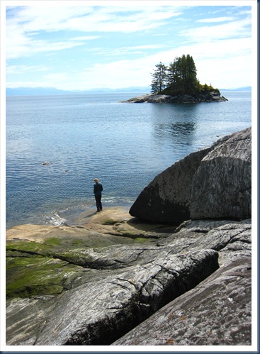
IMG_1043Taking advantage of a high tide and calm seas, we snuck through a shallow passage leading into Queen Charlotte Strait (only bumping the bottom of the dinghy a few times).  With its stunning rock formations, crystal-clear water, piles of weather-beaten logs and expansive views, this stretch of shoreline was by far our favorite.  We spent a few hours here just taking it all in.

IMG_1085

IMG_1068Aaron s-l-o-w-l-y turned for a picture, trying not to lose his balance!

IMG_1080IMG_1078

Down Time

IMG_1017Exploring shell middens and navigating tidal rapids is hard work.  So for a little down time, Aaron and I grabbed a blanket and our Kindles and perched ourselves on a rock in the late afternoon sunshine to do a little reading.  IMG_1018As you can see, though, one of us got a little more reading done and the other a little more snoozing.  But I won’t name any names… 

Moving On

Well, I guess it’s time to move on.  A guy rowed over this morning to make sure that Bella Star wasn’t abandoned, since we’ve been here for so long!  Point taken.  Onward to Port Hardy.

Friday, June 10, 2011

A Black Bear in Turnbull Cove

By Nicole

Well, it happened.  We’d convinced ourselves that it just wasn’t in the cards for us, though apparently it’s commonplace up here.  Day after day went by, and we waited and looked and waited some more.  But today was the day!  Today we saw our first black bear.  I named him Franklin.

I was in the cockpit when I heard the sound of rocks clunking on shore.  We were alone in the anchorage, and I couldn’t figure out what was making all the racket.  I grabbed the binoculars and there it was!  A furry black rump pointed in my direction.  I watched as he turned over rocks looking for a low-tide snack of crabs or other such delicacies.  Aaron was reading or napping  (he goes back and forth between the two quite easily), but he popped up the steps to check out our new friend.  The picture isn’t great (it reminds me of one of those super-zoomed-in Sasquatch shots), but you get the gist.

DSC_0369

Turnbull Cove is surrounded by steep hillsides where two major landslides have occurred in the last few years.  It would’ve probably been fine to anchor near the shore (where we could get close-up pictures of bears), but we read a dramatic account of a boat who witnessed one of the landslides first hand and thought better of it.

IMG_0915
One of two major landslides in Turnbull Cove.

After Franklin had his fill of whatever he was searching for under the rocks, he ambled off into the woods, most likely for a snooze.  It was at about that time when we laced up our hiking boots and set off to find the trail to Lake Huaskin.

IMG_0907 
Handy trail marker, with a lone boot on top.  Hmm.

Along the trail, we came across bear prints in the soft mud and saw bits of black fur on a tree and a pile of bear poo.  Always thinking “safety first,” I made sure to wear my bear bell.  We sounded like a Christmas parade stomping up the trail, but at least we wouldn’t be sneaking up on Franklin or his kin.

IMG_0910 
The back side of the hill had a steep staircase with tiny little steps leading down to the lake.

Before we left Kwatsi Bay Marina, the owner asked us if we knew how to tell grizzly bear scat from that of a black bear. “Grizzly bear scat,” he said, “has bear bells in it.”  Funny guy.

IMG_0911

Of course no anchorage would be complete without a spin in the dinghy to add a few more islands to Aaron’s list (he told you he’s trying to hit 100, right?).

IMG_0928 We sat in this spot for a long time, just soaking in the sunshine and the incredible view.

IMG_0922
Although the view wasn’t too shabby from this side of the island either.

IMG_0927
Or from this side. :)

We’ve spent a few lovely days here in Turnbull Cove, waiting out the gale-force winds blowing on Queen Charlotte Strait.  But with the winds predicted to ease tomorrow, we’ll be moving on.

IMG_0900 Sometimes I feel like we’re in a Bob Ross painting.